THE SPECTACULAR KING TIDES RETURN TO THE OREGON COAST THIS WINTER.
STORY AND COVER PHOTO BY CHERYL WANNER
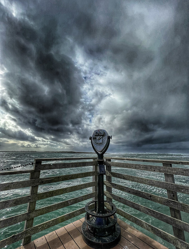
Throw out the term king tide and everyone grabs their cameras and heads for the beach to witness rising waters and big surf action. Not only does this winter event boost coastal economies, but it also provides excellent opportunities for observation and understanding of the oceans and their effect on our planet.
Are king tides a new phenomenon, the result, perhaps, of global warming? Or something that’s been happening since time immemorial and only recently attracted public attention?
The term king tide, coined in Australia in 2009, refers to the highest winter tides of the year. Scientifically, these tides are called perigean spring tides and occur two-to-four times yearly. The name spring tide has nothing to do with the season, but instead refers to the springing forth or rising of water.
Tides are caused by gravitational pulls of the moon and sun, creating bulging on opposite sides of the earth’s surface. High tides, occurring twice a day in most coastal regions, rise along these bulges as the earth’s rotation brings surface areas closer, then retreat as these areas rotate away. Because tides are based on the lunar day—24 hours and 50 minutes—with both moon and earth continually shifting position in relationship to each other, tidal times vary from day to day.
Spring tides occur twice a month at the new and full moons. First and quarter moons—where the sun and moon sit at right angles to each other (in relationship to the earth)—produce lesser high tides known as neap tides.
Perigee happens when the moon is closest to the earth in the earth’s elliptical orbit. When earth, moon, and sun fall into direct alignment (called syzygy) during a winter spring tide, the result is a perigean spring (or king) tide. Unlike winter storms, king tides are calculatable and can be accurately predicted. Such tides coinciding with storms run even higher than they would otherwise, often resulting in flooding and accompanying erosion and property damage. By contrast, the corresponding low tide will fall lower than normal.
The earth’s orbit brings it closest to the sun between the second and the fifth of January each year, an event known as perihelion. The moon’s perigee and earth’s perihelion change from month to month, but an alignment of the two will produce the highest tides possible. This last occurred in 1912 and won’t happen again until 2045.
HOW TO VIEW KING TIDE ACTION
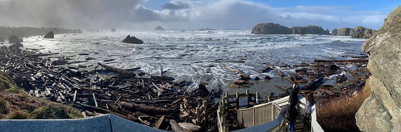
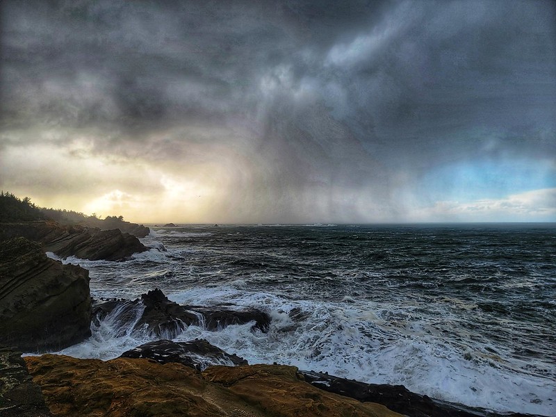
King tides and their effects can be seen along beaches with much higher than normal shoreline run ups. Beaches, bays, and estuaries are great locations for observing rising water levels (especially contrasted against onshore topography and buildings) with surf sometimes washing into the mouths of rivers and creeks. Keep in mind that surf may or may not be higher than normal as a king tide does not equate storm conditions. However, on rocky coastlines, you should see some explosive action.
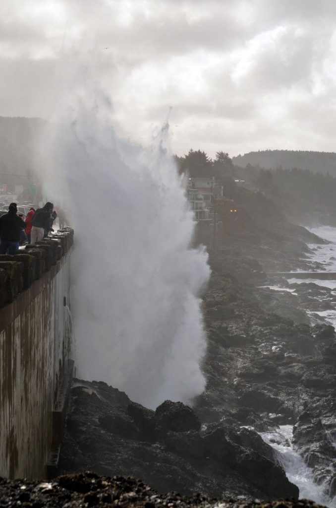
For spectacular wave shots, head for basaltic rock with elevated vantage points and safe areas well back from breaking surf. Depoe Bay (including nearby Boiler Bay and Rocky Creek State Waysides), Seal Rock, Yaquina Bay Outstanding Natural Area, Yachats, and Cape Perpetua Scenic Area on the central coast all provide exceptional viewing opportunities. The seawall at Depoe Bay will put you on the edge of the action—you might even get wet, but you’ll be safe while you do!
Access to basaltic areas on the north coast is harder to find and most are unprotected, though the parking lot at Indian Beach (Ecola State Park) and the end of the Short Sands Beach Trail (Oswald West State Park) offer elevated vantage points. On the south coast, Samuel Boardman State Scenic Corridor and Harris Beach are great choices. Particularly epic viewing is available at Shore Acres State Park and Cape Arago, southwest of Coos Bay.
SAFETY TIPS
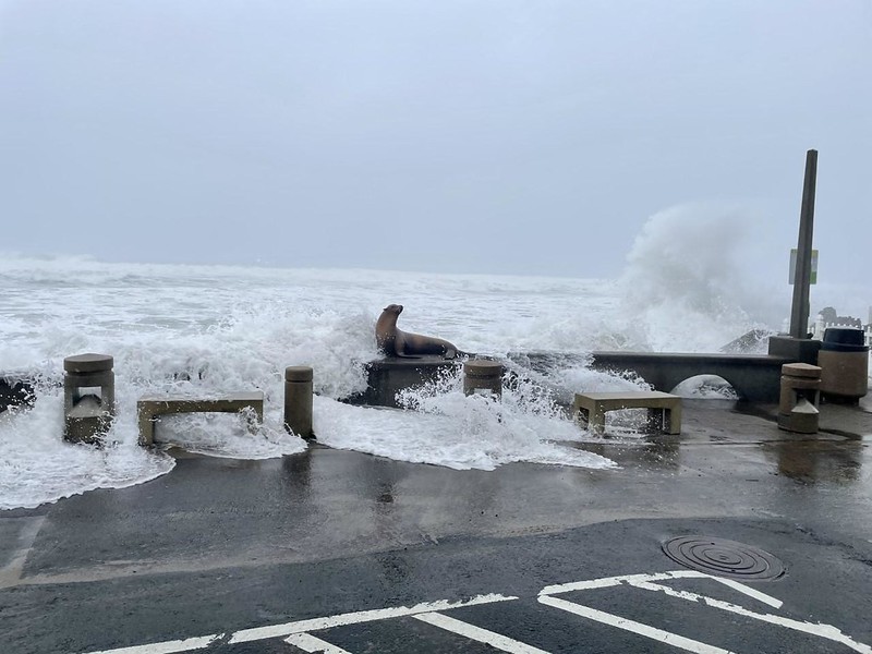
Spectacular surf explosions off basalt outcroppings are particularly photogenic, but carry inherent risks, so extreme caution is advised. Stay well back of exposed rocks and ledges (typically wet and slippery), spouting horns and chasms, such as Cook’s Chasm and the Devils Churn (Cape Perpetua), and collapsed sea caves like Thor’s Well (Cape Perpetua). Be aware that shattering surf may cover a greater area than expected. Avoid jetties as these are exceptionally dangerous. Stay off beaches as surf may overrun everything below bluffs and parking areas, shifting driftwood and sucking logs—or unwary observers—out to sea.
Wear closed-toed, nonslip shoes and water-protective clothing. Weather can change in a moment, so check the forecast frequently. Never turn your back on the ocean.
THE IMPORTANCE OF STUDYING OF KING TIDES
As polar ice caps melt and seas rise, the study of king tides and their effect on coastlines becomes increasingly important. Where might erosion or flooding occur? What measures should be taken to stabilize such areas, protecting both citizens and the environment? What today is a noteworthy event may become tomorrow’s norm.
The Oregon King Tides Project is dedicated to studying and documenting these extreme surges and their effects on coastal regions. This is done primarily through photographs supplied by the public for study and comparison. Photos involving all aspects of king tides—wave action, flooding, aerial shots, erosion, and comparison views between “normal” high and “king”—are welcome. Most useful are those showing structures such as pilings, docks, buildings, parking lots, roads, and bridges being affected by tidal surges. Pics of estuaries and tidal rivers are of particular interest. Photographic records of the reach of these tides are used to create maps to help community leaders plan for the future.
The best time for photo-shooting is at peak high tide, but great pics can be taken on either side of this window. Photographers submitting their work to the King Tides Project will be credited for any shots used. The King Tides Project is also partnering with the Oregon Coast Visitor’s Association for its yearly king tide photo contest, which ends in February with prizes awarded. Visit their website at www.oregonkingtides.net for details.
UPCOMING KING TIDES
Stay tuned for dates for 2024-2025 winter’s king tides along the Oregon Coast.
Tides run high on either side of these days. Consult tide charts for times based on the area you will be visiting. Take extra care and enjoy the show!
FOR MORE INFORMATION
What is a King Tide? oceanservice.noaa.gov
Oregon King Tides Project oregonkingtides.net
How and Where to Safely Observe King Tides of the Oregon Coast travelawaits.com
King Tide: A Cosmic Phenomenon caseagrant.ucsd.edu
The Science Behind King Tides theweathernetwork.com
Online exclusive story for Oregon Coast magazine, posted December 14, 2021. Updated October 30, 2023.